GTAXTREME
Find Waning Sands in Leonard County and plan four mapped stops: the town area, Evergreen Shopping Mall, station and Pay ’n’ Spray.
The Waning Sands name on Leonida’s eastern side is a town destination, not the name of a single collectible. If you are heading there for shopping, set a second waypoint for Evergreen Shopping Mall. The town label and the mall identify different parts of the area.
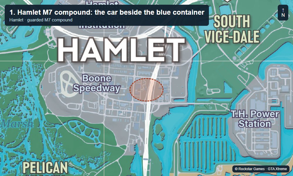
Waning Sands lies in Leonard County, north of Vice City. The official map places the Evergreen complex southwest of the town label. This guide separates orientation, shopping, rail travel and vehicle repairs into four maps, so you can choose the stop that matches your errand.
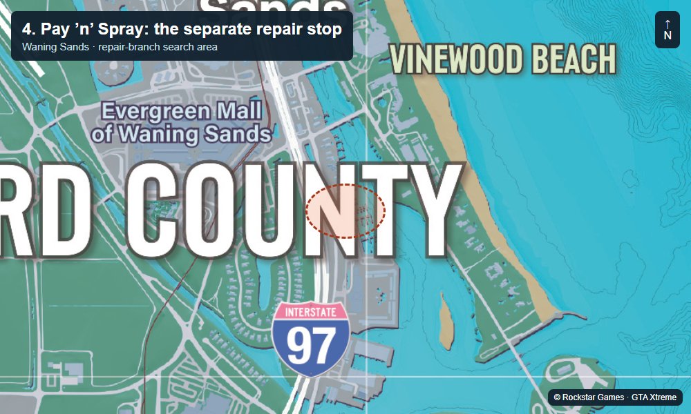
The circles below are location areas rather than exact entrances. The station and repair branch retain their published directory coordinates; the map does not verify a particular door or platform. Use the named building and the current in-game interaction when finishing each approach.
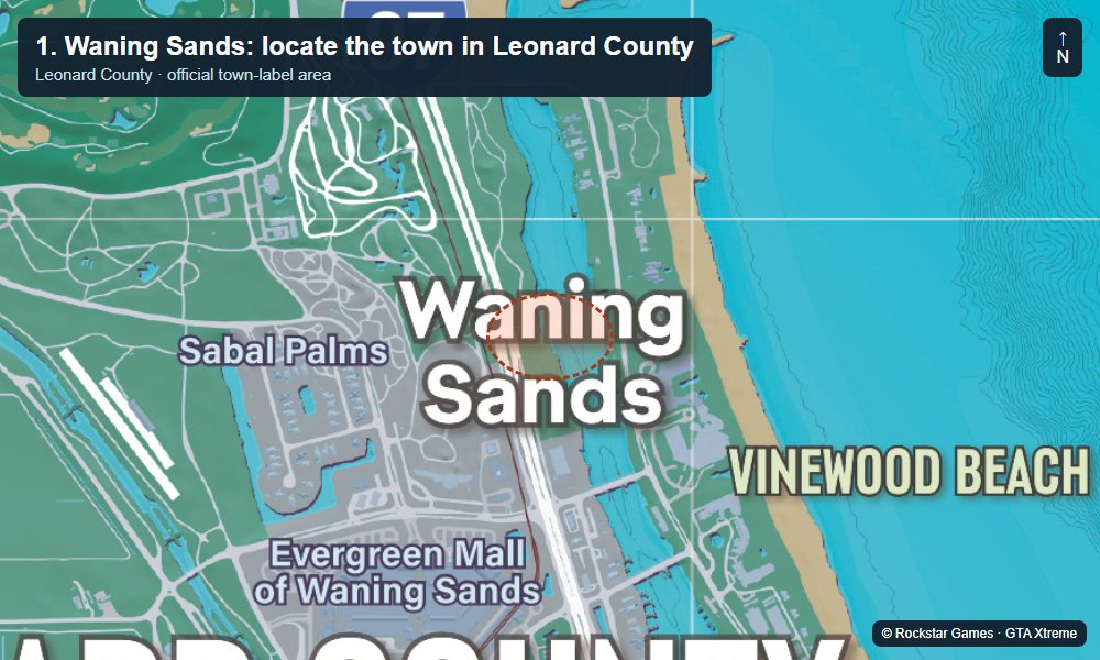
1. Waning Sands: locate the town in Leonard County
From Vice City follow the road network north into Leonard County and select the Waning Sands area on the eastern side. If you are coming from Millport, approach from the north. Let the waypoint route choose the connecting streets instead of driving toward the map label in a straight line.
Use this first circle to establish which town you are in. It marks the official town label rather than a central service counter. For a useful first errand, continue southwest to the mall map below. The cities and towns directory helps compare this destination with other named settlements.
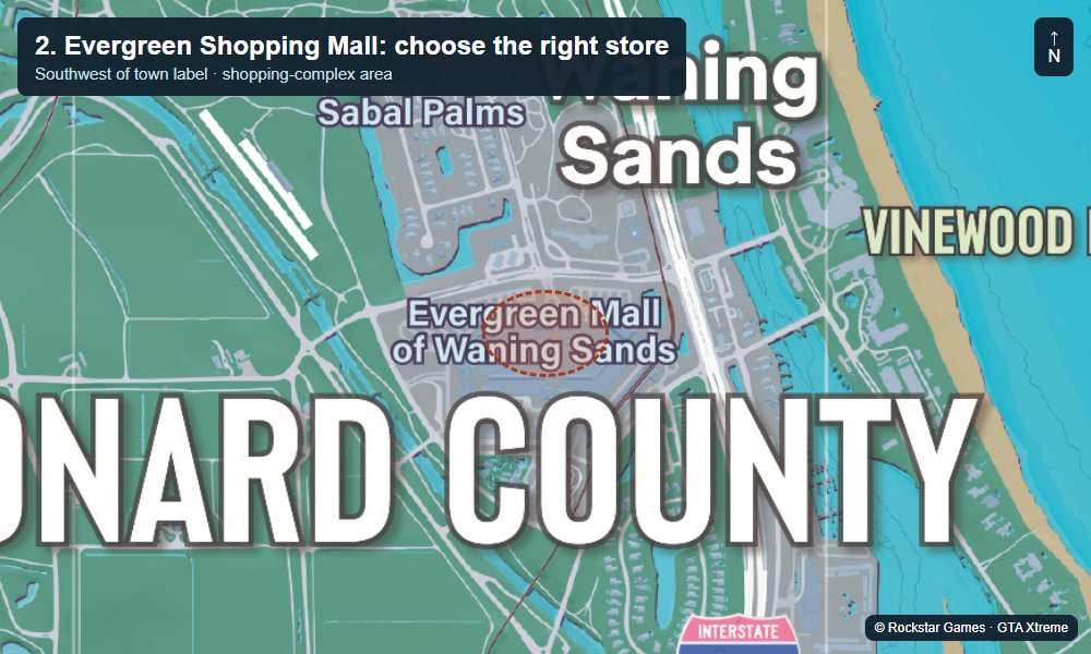
2. Evergreen Shopping Mall: choose the right store
Head southwest from the town area to Evergreen Shopping Mall. Use the shopping-complex label and road entrances to reach the property, then park and explore on foot. One map covers this single mall complex; the individual shops are not additional town-centre destinations.
For Waning Sands, the clothing directory lists This & That, Mid, Alpha Sports and Ferruccio Tucci in the Waning Sands shopping area. Compare store signs before entering. Their close spacing makes it more useful to walk between storefronts than to set a new driving route for each brand.
For footwear, check the shoe store directory and identify the branch you actually want. The restaurant directory provides food stops in the wider town area. Do not assume that every restaurant entry shares the mall interior merely because it is listed under Waning Sands.
Project Lan’s video shows a night-time walk through the shopping complex and several storefronts. Use the first minutes to recognise the pedestrian setting. Later scenes include unrelated wandering and combat, so the clip is visual orientation rather than a promise that every door or purchase is available at your story stage.
The opening part shows the shopping complex on foot. The full video continues into other activities; use it for visual orientation at the mall.
Watch Project Lan’s night-time mall walk
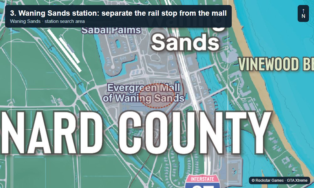
3. Waning Sands station: separate the rail stop from the mall
Find the Waning Sands rail-stop area close to the shopping district on the town’s southwestern side. Select this station marker if your goal is rail travel. Do not leave the waypoint on a clothing shop and expect it to finish at the station entrance.
On arrival, identify the station and follow its transport interaction. Check the available destinations and any current access requirements before confirming a journey. The train station directory gives you the other mapped stops for planning onward travel. This circle is the station area, not an independently checked platform entrance.
4. Pay ’n’ Spray: the separate repair stop
For car repairs, use the Waning Sands Pay ’n’ Spray marker southeast of the mall area. Approach along the local roads and confirm the business sign before pulling toward the service entrance. The repair branch is a separate destination from the pedestrian shopping complex.
Read the current service prompt and price before confirming work. The Pay ’n’ Spray directory provides other branches if you continue across Leonida afterward. Repairing a car does not by itself establish ownership. Use the registration guide, if your aim is to keep a vehicle you picked up during the trip.
Map by Rockstar Games. Markers and screenshots by GTA Xtreme.
Choose one practical route through the area
For a shopping visit, start with the mall and choose only the stores you need. For onward rail travel, switch to the nearby station marker before leaving the shopping area. If you arrived by car, finish at the repair branch only when the vehicle actually needs attention.
Before a larger shopping trip, the ATM guide helps with money management and the easy money guide offers mapped activities for building a budget. Treat Waning Sands as a useful service area rather than expecting its town label to contain a single cash reward or collectible.
Video: a walk through the shopping complex
The opening part shows the shopping complex on foot. The full video continues into other activities; use it for visual orientation at the mall.